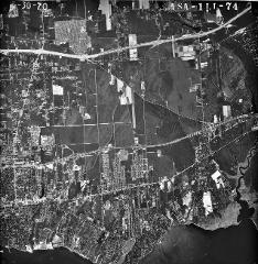
SC_5_30_70_1LL-74
SC_5_30_70_1LL-74
| dc.date.accessioned | 2021-08-14T17:40:27Z | |
| dc.date.available | 2021-08-14T17:40:27Z | |
| dc.identifier.uri | http://hdl.handle.net/11401/89289 | |
| dc.subject | Long Island (N.Y.) - History - Aerial Imagery. | |
| dc.title | SC_5_30_70_1LL-74 | |
| dcterms.creator | Lockwood, Kessler, and Bartlett, Inc. | |
| dcterms.creator | United States, Soil Conservation Service | |
| dcterms.dateAccepted | 2012-09-17 | |
| dcterms.description | Aerial(s) Local Government Zoning | |
| dcterms.extent | 24cm X 24cm | |
| dcterms.identifier | SC_5_30_70_1LL-74.tif | |
| dcterms.identifier | 13.jpg | |
| dcterms.isPartOf | Maps Collection, Stony Brook University Libraries | |
| dcterms.issued | 1970-05-30 | |
| dcterms.modified | 2014-06-18 | |
| dcterms.provenance | Nassau & Suffolk County Readme: This set contains 9” x 9” black and white aerial photography of Suffolk County (and some Nassau County) taken in 1970. Photos were loaned by the Stony Brook University Library, Special Collections with the assistance of Kristen Nyitray and Jason Torre. Each photo was scanned by Amy Hapeman in June of 2004 with an Epson 836XL flatbed scanner at 600 dpi as a 24 bit RGB color *.tif file using Adobe Photoshop 7.0. Each image is oriented with north at the top of the photograph. The files are indexed such that the file name is XC (X County)_date_series_xxx(number of photo).jpg. Photos may be from the Soil Conservation Service due to the letters ‘SCS’ printed in some of the photos. Scale: 1:50000. Gauges seen in the frame of two untrimmed photos (#1LL-01, -102) may reveal a flight time. Fred Mushacke NYS Dept. of Environmental Conservation | |
| dcterms.provenance | 1 | |
| dcterms.provenance | 9767960 | |
| dcterms.provenance | 9.32 MB | |
| dcterms.spatial | Suffolk County, 1970 | |
| dcterms.spatial | SCS-1:50000 | |
| dcterms.subject | Long Island (N.Y.) - History - Aerial Imagery. | |
| dcterms.title | SC_5_30_70_1LL-74 | |
| dcterms.type | Image |

