ASA_5_17
ASA_5_17
| dc.date.accessioned | 2021-08-14T17:48:18Z | |
| dc.date.available | 2021-08-14T17:48:18Z | |
| dc.identifier.uri | http://hdl.handle.net/11401/89600 | |
| dc.subject | Long Island (N.Y.) - History - Aerial Imagery. | |
| dc.title | ASA_5_17 | |
| dcterms.creator | United States, Department of Agriculture | |
| dcterms.dateAccepted | 2012-11-27 | |
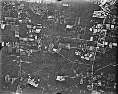
| dcterms.description | Aerial(s) Local Government Zoning | |
| dcterms.extent | 24cm X 24cm | |
| dcterms.identifier | ASA_5_17.jpg | |
| dcterms.identifier | 721.jp2 | |
| dcterms.isPartOf | Maps Collection, Stony Brook University Libraries | |
| dcterms.issued | 1938-07-07 | |
| dcterms.modified | 2014-06-18 | |
| dcterms.provenance | This digital image was scanned from the original, black and white, contact print using a Canon CanoScan 9000F flatbed scanner and Apple Mini MAC operating system; master images were captured as 600 dpi, 8 bit greyscale, TIFF file format. Access version contained herein is variable and dependent upon user requirements. | |
| dcterms.provenance | 1 | |
| dcterms.provenance | 6755480 | |
| dcterms.provenance | 6.44 MB | |
| dcterms.spatial | Patchogue | |
| dcterms.spatial | Suffolk County, 1938 | |
| dcterms.spatial | AAA-1:20000 | |
| dcterms.subject | Long Island (N.Y.) - History - Aerial Imagery. | |
| dcterms.title | ASA_5_17 | |
| dcterms.type | Image |