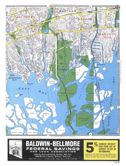
N-14-25 - 1972 Hagstrom Nassau Street Maps
N-14-25;
1972 Hagstrom Nassau Street Maps
| dc.date.accessioned | 2021-08-15T06:13:48Z | |
| dc.date.available | 2021-08-15T06:13:48Z | |
| dc.identifier.uri | http://hdl.handle.net/11401/90487 | |
| dc.title | N-14-25 - 1972 Hagstrom Nassau Street Maps | |
| dcterms.dateAccepted | 2014-06-05 | |
| dcterms.description | 1972 Hagstrom Atlas. Street map of Seaman's Island, East Bay, and South Massapeaqua. | |
| dcterms.format | Image/TIFF | |
| dcterms.identifier | 45.tif | |
| dcterms.issued | 1972 | |
| dcterms.modified | 2014-06-18 | |
| dcterms.provenance | 6/6/2008 | |
| dcterms.rights | Campus Only | |
| dcterms.title | N-14-25 | |
| dcterms.title | 1972 Hagstrom Nassau Street Maps |

