S-9-1
S-9-1
| dc.date.accessioned | 2021-08-17T07:12:53Z | |
| dc.date.available | 2021-08-17T07:12:53Z | |
| dc.identifier.uri | http://hdl.handle.net/11401/92841 | |
| dc.title | S-9-1 | |
| dcterms.creator | United States Geological Survey | |
| dcterms.dateAccepted | 2014-06-18 | |
| dcterms.description | United States Geological Survey | |
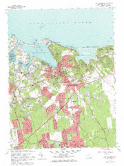
| dcterms.description | 1967 USGS Topographic Brookhaven | |
| dcterms.description | 1967 US Geological Survey 10 Ft Contour Map of Port Jefferson and Brookhaven | |
| dcterms.identifier | o40073h1.tif | |
| dcterms.issued | 1967 | |
| dcterms.language | en | |
| dcterms.rights | Campus Only | |
| dcterms.title | S-9-1 | |
| dcterms.type | Image |