S-10-2
S-10-2
| dc.date.accessioned | 2021-08-17T07:13:00Z | |
| dc.date.available | 2021-08-17T07:13:00Z | |
| dc.identifier.uri | http://hdl.handle.net/11401/92846 | |
| dc.title | S-10-2 | |
| dcterms.creator | Hugo L. Dickins | |
| dcterms.dateAccepted | 2014-06-18 | |
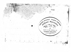
| dcterms.description | United States Coast Survey | |
| dcterms.description | 1830s Coast Survey Patchogue | |
| dcterms.description | 1836 US Coast Survey Map of Patchogue Bay and Islip | |
| dcterms.description | Poor copy quality with pen writing present. Includes hand drawn map with a seal in the bottom right | |
| dcterms.identifier | Map255.tif | |
| dcterms.issued | 1836 | |
| dcterms.language | en | |
| dcterms.rights | Campus Only | |
| dcterms.title | S-10-2 | |
| dcterms.type | Image |