LI-18-1
LI-18-1
| dc.date.accessioned | 2021-08-17T16:07:37Z | |
| dc.date.available | 2021-08-17T16:07:37Z | |
| dc.identifier.uri | http://hdl.handle.net/11401/92878 | |
| dc.title | LI-18-1 | |
| dcterms.dateAccepted | 2014-06-05 | |
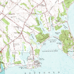
| dcterms.description | Topographic map of Southold and Cutchogue Harbor | |
| dcterms.description | `Unknown date and origin. Map has bathymetric contours no units labeled` | |
| dcterms.format | Image/TIFF | |
| dcterms.identifier | o7054d.tif | |
| dcterms.modified | 2014-06-18 | |
| dcterms.rights | Campus Only | |
| dcterms.title | LI-18-1 |